
Rose City Land Clearing connects Chandler property owners with a local land clearing provider for forestry mulching, lot opening, brush clearing, and site support around Chandler.
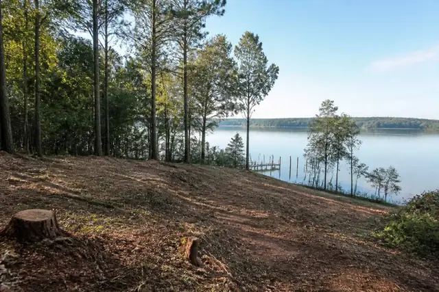
Chandler requests can involve sloping acreage and Lake Palestine influence, where view opening, shoreline vegetation, and machine access compete within a small footprint. The safest plan begins at the water-side edge and works back toward a stable route.
A calm bank can still hide soft soils, erosion, buried service, or a steep return path for loaded equipment. Selective limits usually matter more here than a broad acre-based clearing target.
Work near water should begin with parcel-specific jurisdiction, buffer, and drainage questions. After those limits are marked, the provider can price understory opening, stump work, debris placement, and any upland access separately.
Rose City Land Clearing connects Chandler owners with a local provider who inspects the slope and proposes only the work supported by the site and approved boundaries.
Open a lake view without treating the bank as ordinary upland
A selective view corridor can retain bank-stabilizing roots and mature canopy while removing designated privet, vines, or low brush. The Texas A&M Forest Service vegetation-management guidance supports matching treatment to species and land goals, but parcel rules and shoreline jurisdiction still need confirmation from the responsible authority.
The USDA NRCS Web Soil Survey can show mapped soils around the Chandler area, yet an onsite check must verify bank moisture, seepage, erosion, slope, and a safe turn location. Heavy equipment should not enter a shoreline strip merely because the upland portion is firm.
Keep excavation and exposed-soil questions upstream of production
Stump extraction, bank shaping, or a new access cut can disturb soil and alter runoff. The TCEQ construction-stormwater page explains state construction coverage thresholds, while other lake, waterway, local, or property restrictions must be resolved for the specific parcel before the quote includes earthwork.
If grubbing or excavation is approved, the Railroad Commission of Texas damage-prevention program provides official locate guidance. Docks, irrigation, septic, pumps, and private electric service can require additional records or specialist locating beyond public utility markings.